For several years, Systerel has been developing an innovative railway data display solution. This solution represents tracks, equipment, specific objects, zones, and their detailed characteristics in a cartographic format.
The concept is based on creating an interactive web page that allows users to navigate smoothly and intuitively on the railway map, similar to “Google Maps,” while filtering the data they wish to display.
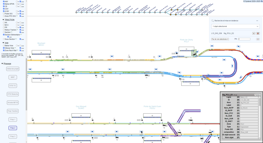
A Railway Data Display Solution Adopted by the RATP
Systerel has customized this solution for the RATP, which uses it to verify the configuration data of Line 13 of the Paris metro. Easy to use and leveraging a familiar format for operators, this tool also includes advanced features, such as comparing multiple development phases of a metro line.
Building on this success, the RATP plans to extend the use of this solution to other operated lines.
This project illustrates Systerel’s proactive approach. By anticipating the implementation of new technologies, the company helps improve and accelerate the production of its clients’ systems.